What Are Statoids?
Home Buy data Donate
The land area of the world is divided into countries (1). Most of the countries are, in turn, divided into smaller units. These units may be called states, provinces, regions, governorates, and so on. A phrase that describes them all is "major administrative divisions of countries". I will use the term "statoid" for short. Since the word has no other accepted meaning (2), it can be used as a search term on search engines to target this site. The 'a' of statoid is long.
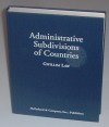
This page is a guide to Internet sites about the statoids of each country. It can be used independently, but it is meant to be an update to the book "Administrative Subdivisions of Countries", by Gwillim Law (McFarland & Company, Jefferson, North Carolina) (3). The international standard ISO 3166 is the source for the list of countries. As a result, some dependencies, and a few integral parts of larger countries, are listed as if they were separate countries.
Can continents be used to define another hierarchical level of subdivisions, below the whole world and above the countries? There are some difficulties with that idea, which I discuss on the Continents page.
The book and website attempt to satisfy two types of inquirer: those who simply want a quick answer to a specific question about present-day subdivisions, and those who want to solve a problem involving conflicting data from different sources. The first type should consult the main table for each country, which will be the first table in that country's article. Tables with a yellow color scheme contain the most current list of subdivisions available; tables with a purple color scheme are historical or supporting data.
For selected countries, I've posted lists of the secondary administrative subdivisions on this website. For example, to find the counties of the United States, click on "U" on the alphabet bar. Find the row of the table for the United States, and click on "county" in the column headed "Secondary". The primary subdivisions of countries change fairly often. There are perhaps a couple of dozen changes a year among all the countries of the world. The secondary subdivisions are more numerous, and governments can change them with fewer repercussions. Their changes are much more frequent. So be aware that the secondary division lists may not be up to date.
There are also some general reference sites which have information about many countries:
- The CIA World Factbook
 has basic facts about every country in the world. In regard to statoids, it usually has a list of names, and indicates the type of
statoid (state, province, region, etc.). The Factbook is revised every year, and many of the earlier editions can still be found on
the Web. Some of them are at Project Gutenberg .
has basic facts about every country in the world. In regard to statoids, it usually has a list of names, and indicates the type of
statoid (state, province, region, etc.). The Factbook is revised every year, and many of the earlier editions can still be found on
the Web. Some of them are at Project Gutenberg . - The Library of Congress Country Studies are a series of
on-line books. They cover fewer countries than the World Factbook, but in much greater depth. To find information about
administrative divisions: click "Browse", click on a country name, and search for the text "Local Government".
- The U.S. State Department publishes Background Notes
on many countries. They sometimes mention recent changes in the country divisions.
- Maps: The Perry-Castañeda Library
(PCL) at the University of Texas at Austin has a large number of digitized map images. ReiseNett, a Norwegian travel business, has a
partial mirror of the PCL collection. The Africa
Data Dissemination Service (ADDS) website has a
collection of administrative
maps of African countries.
- Postal information: The Universal Postal Union (UPU) is an international body concerned with postal services
across borders. Postal
Addresses is a set of documents which give sample address formats for many countries. Many of them
explain the postal code system and give lists of statoids. An earlier version of this compilation may be found at the
sendtelegram.com commercial site.
- Graham Rhind maintains an Address Formats page with
links to many post offices and postcode pages. PostInfo is another
such site. Postcode.ws has a searchable database of postal codes
for many countries.
"Frank's Compulsive Guide" is a worldwide survey of address
formats in one page.
- Telephone codes: The Telecom
Archives contain text files that explain the international telephone numbering system, including the
international dialing codes for each country, and often the regional telephone prefixes within a country, sometimes down to the city
level. Look at files beginning with "zone.4" for countries whose international dialing code starts with 4, for example.
Numbering Plans is another
page with information about the significance of telephone prefixes.
- Time zones: The Olson tz database is a moderated, user-maintained source that has the most complete and
up-to-date information available on worldwide time zones. A good explanation can be found at this
time zone page.
- Censuses: The International Census
Collection Online Catalog is a catalog of national censuses in university libraries. The U.N.
Statistics Division has a list of
dates of recent and anticipated censuses. I kept a copy of the U.S. Census
Bureau's list of census dates by country (1946-2014), now departed from the Internet.
- Standards: The ISO 3166 Maintenance
Agency home page has answers to most questions about ISO 3166. ISO codes can be searched via the
Online Browsing Platform .
- The U.S. government has promulgated various Federal Information Processing Standards.
FIPS PUB 10-4 is one of them. It provides a
four-character code for each statoid. It was discontinued in 2008, but its successor, "Geopolitical Entities and Codes", is still
being kept up. The National Geospatial-Intelligence Agency
site is now the home page for Geopolitical Codes. It offers a worldwide (except U.S.) gazetteer that uses those codes to identify
subdivisions.
- The United Nations Geographic Information Working Group (UNGIWG) was compiling a database of Second Administrative Level Boundaries called SALB. The database, free registration required to access data, was at http://www.unsalb.org/. It's not responding now.
- The Institute of the Estonian Language (Eesti Keele Instituut) has a Place Names
Database which includes lists
of administrative subdivisions.
- Wikipedia has lists of country
subdivisions . There is also a site called Open Street
Map , with user-contributed geographic data, and an accompanying wiki that has a reference for
administrative subdivisions .
- Private pages: Other individuals have made compilations of countries with statistics by administrative division.
Johan van der Heyden has a site for global statistics.
Thomas Brinkhoff is focused on city populations,
but for many countries he has lists of administrative divisions with interactive maps. The
GeoNames site has an interface for users to modify the data,
wiki-style.
Jan Lahmeyer has historical population statistics.
Dirk Schönberger concentrates
on flags. A private firm named Demographia has put a lot of
census information for various countries on line. Werner
Fröhlich's Geonames site lists geographical names in many languages.
Geopostcodes is a commercial site with limited free
samples; my HASC codes are included in the data they sell.
If you would like a generic word for secondary administrative divisions, I've coined the term "districles" (many countries call them districts). I also call the lowest-level administrative divisions in each country "municities"; often, the term actually used is commune or municipality. Pronounce municity with the accent on the second syllable, mew-NIH-sih-tee.
Footnotes:
1. It would be easy to quibble with this statement. (What about Antarctica? What about the various neutral and demilitarized zones, such as between North and South Korea? Are dependencies supposed to be counted as separate countries, or parts of their mother countries?) All I mean to say here is that, using national sovereignty as a basis, it's possible to divide the entire land area of the world up into disjoint named areas. Admittedly, to do so, you would have to make some arbitrary decisions about nationhood and boundaries.
2. There are some websites that apparently use the word "statoids" to mean isolated statistical statements, analogous to factoids. I haven't seen it in any dictionary yet.
Why "statoid"? In English, the suffix "-oid" can usually be understood as "-like". An asteroid is a "star-like" object (aster = star); a spheroid is something that's close to spherical, but not quite; an android is a robot that's shaped like a man (andr- = man).
 3. The book "Administrative Subdivisions of Countries" can be ordered from
Barnes and
Noble , Amazon.com ,
or direct from McFarland . To
order through your independent bookseller, ask for ISBN 978-0-7864-6097-7. Finally, I myself have a few spare copies for sale. If
interested, please contact me.
3. The book "Administrative Subdivisions of Countries" can be ordered from
Barnes and
Noble , Amazon.com ,
or direct from McFarland . To
order through your independent bookseller, ask for ISBN 978-0-7864-6097-7. Finally, I myself have a few spare copies for sale. If
interested, please contact me.
This website has been maintained since May, 1999. In 2003, it was receiving so many hits that the Internet service provider's bandwidth limit was exceeded, so I switched to a different ISP, and necessarily changed the URLs; however, I maintained redirects from the old pages to the new ones for six months. Some URLs on this site are based on ISO country codes; when those codes change, the address for the corresponding country changes, although I try to keep the old URL with a redirect. With those exceptions, the URLs for pages on this site have never changed.
| Back to main statoids page | Last update: 2015-01-05 |
| Copyright © 1999-2015 by Gwillim Law. | |