
| To find links for a specific country, click on its initial letter here: |
|
If you don't find the country name you're looking for here, try the Country cross-reference page.
| Country | Primary | Secondary | Stats  | Postcode | Maps | TZs |
|---|---|---|---|---|---|---|
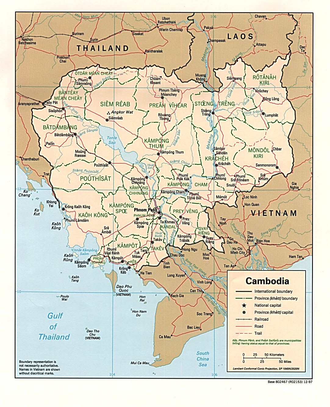
| Cambodia | province | district | Stats | CIA Map Map Mgl PDF PDF | +07:00 | |
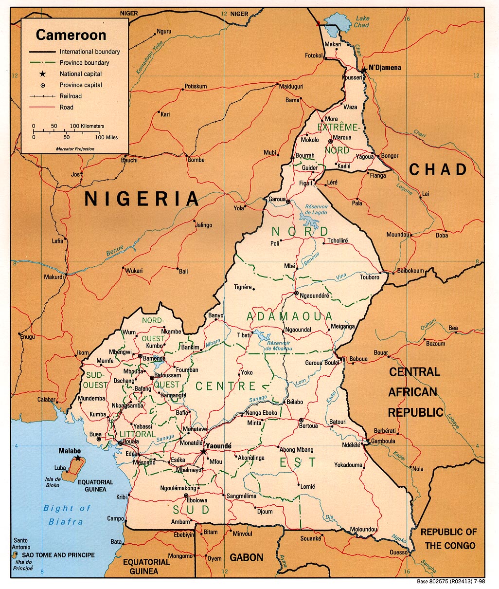
| Cameroon | region | department | Stats | CIA Map Map Mgl PDF | +01:00 | |
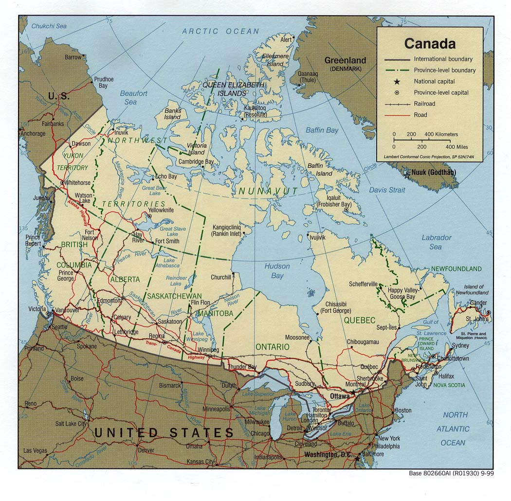
| Canada | province | county | Stats Stats Stats Stats Stats Stats | Atlas CIA Map Mgl | Zones D | |
| Cape Verde | county | parish | Stats Stats | CIA Map Mgl | -01:00 | |
| Cayman Islands | district | Stats | Map | -05:00 | ||
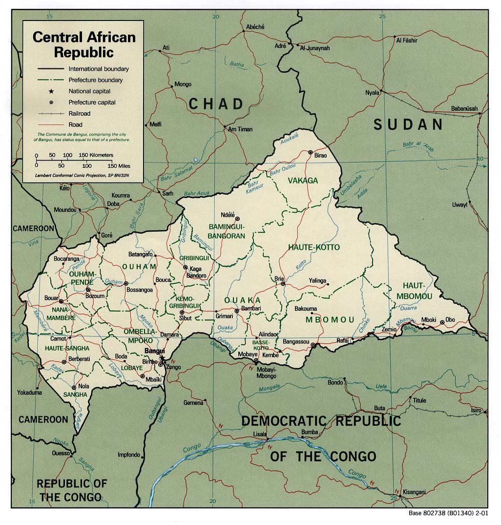
| Central African Republic | prefecture | sub-prefecture | Stats Stats Stats | CIA Map Map Mgl PDF PDF PDF | +01:00 | |
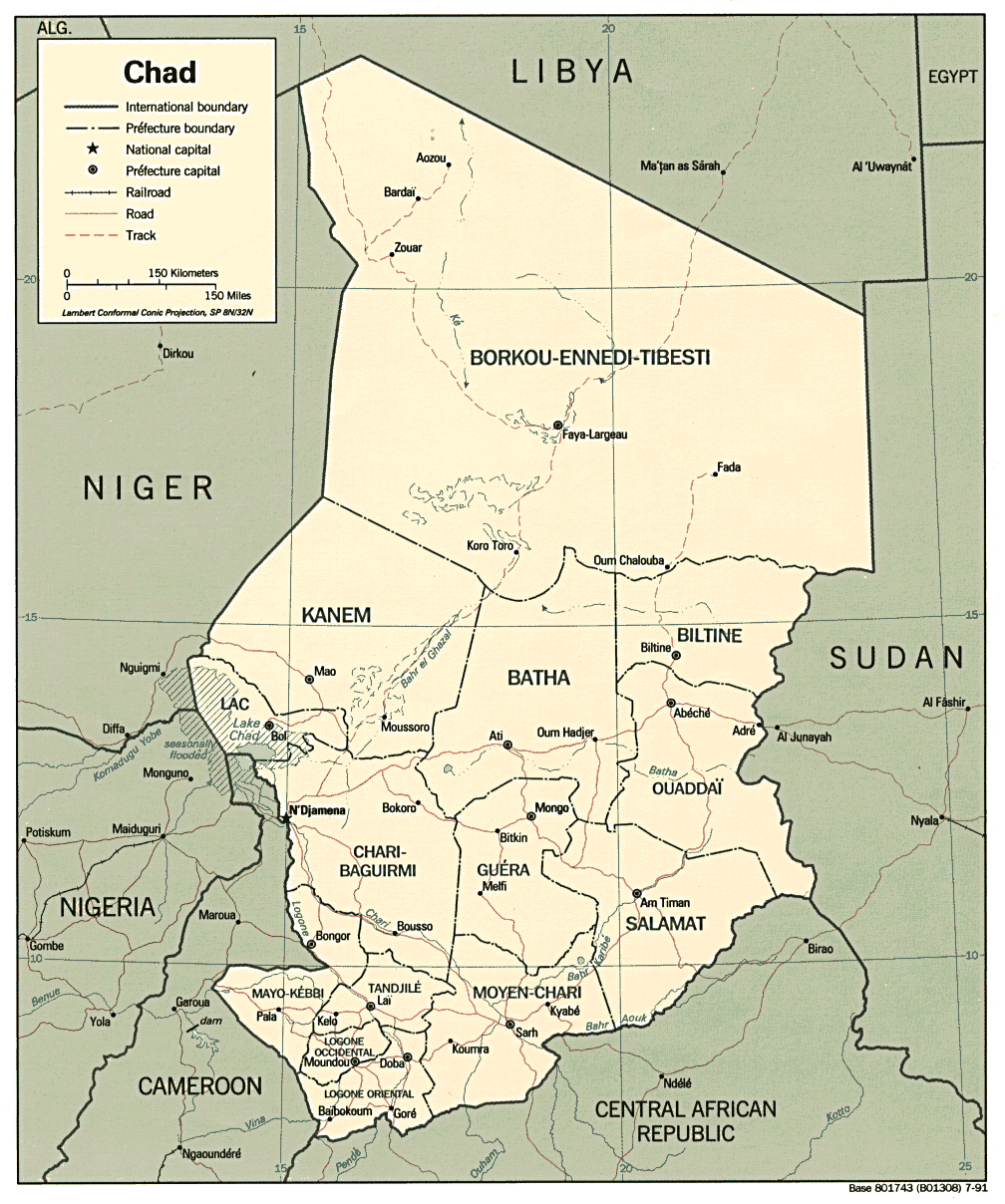
| Chad | region | department | Stats | CIA Map PDF PDF PDF | +01:00 | |
| Chile | region | province | Stats | Post | Mgl PDF | Zones D |
| China | province | prefecture | Stats Stats Stats Stats Stats | CIA Mgl PDF | +08:00 | |
| Christmas Island | none | +07:00 | ||||
| Cocos (Keeling) Islands | none | +06:30 | ||||
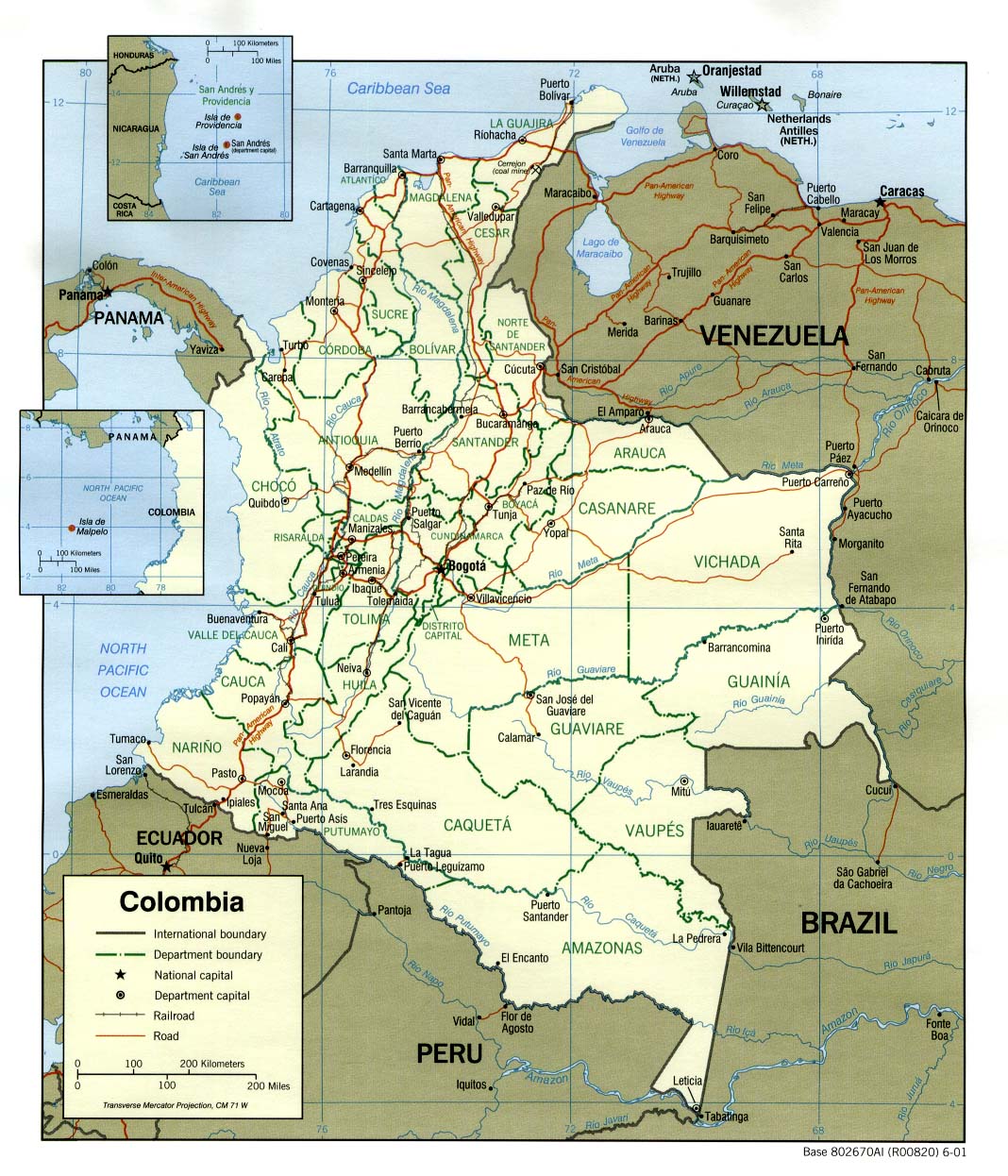
| Colombia | department | municipality | Stats | CIA Clik Mgl PDF | -05:00 | |
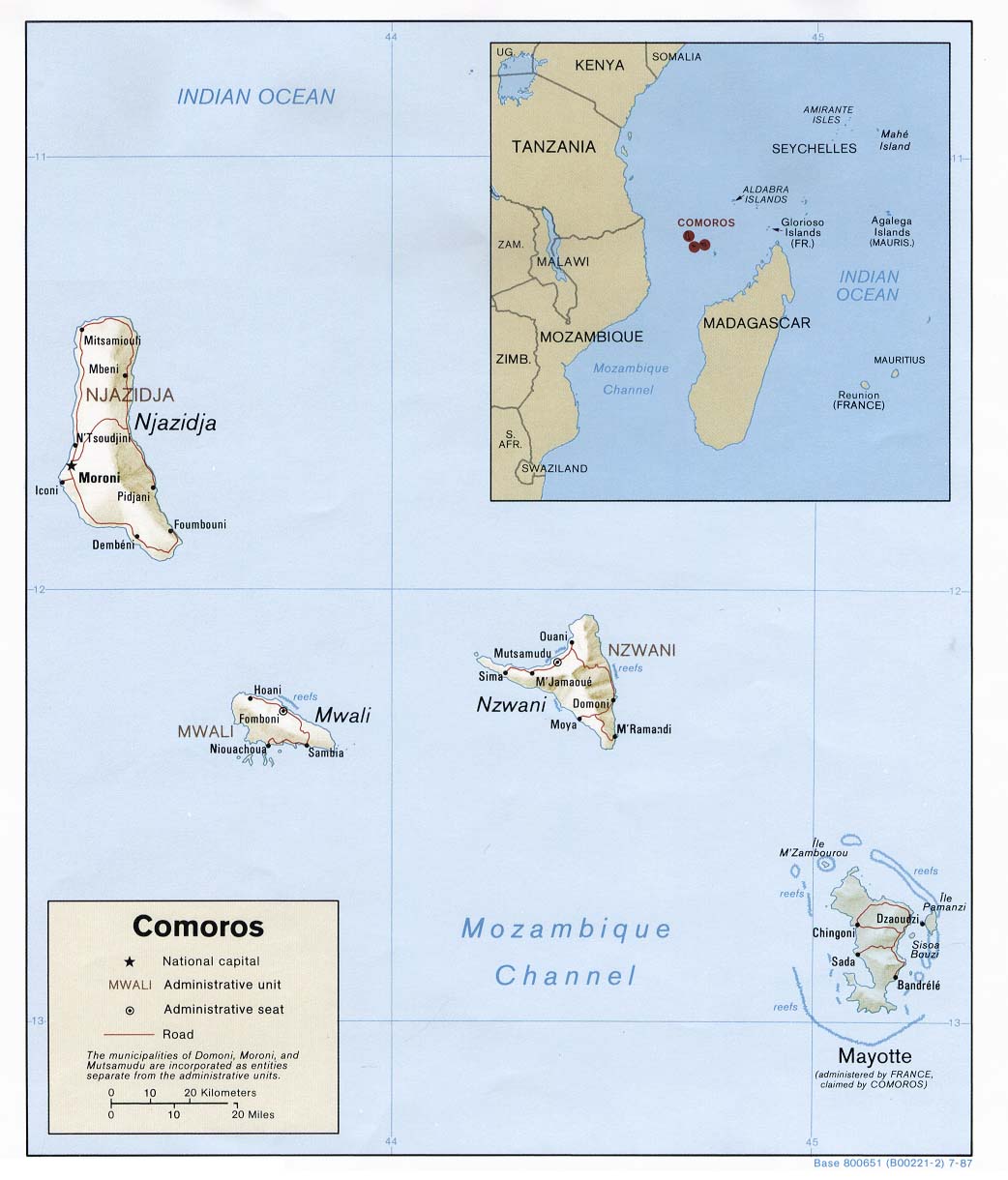
| Comoros | autonomous island | CIA Mgl PDF | +03:00 | |||
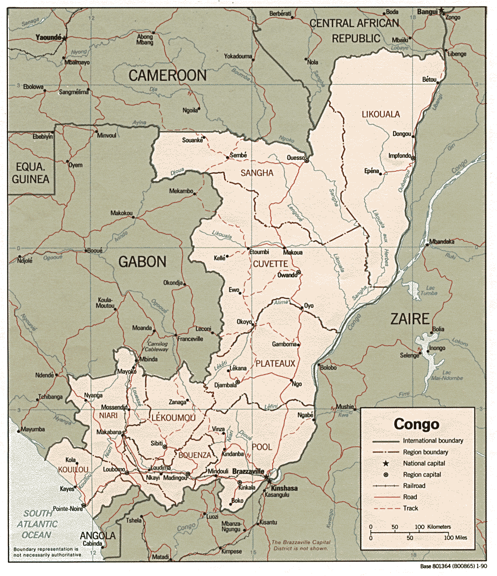
| Congo (Brazzaville) | department | district | Stats Stats | CIA Clik Map Mgl PDF PDF PDF | +01:00 | |
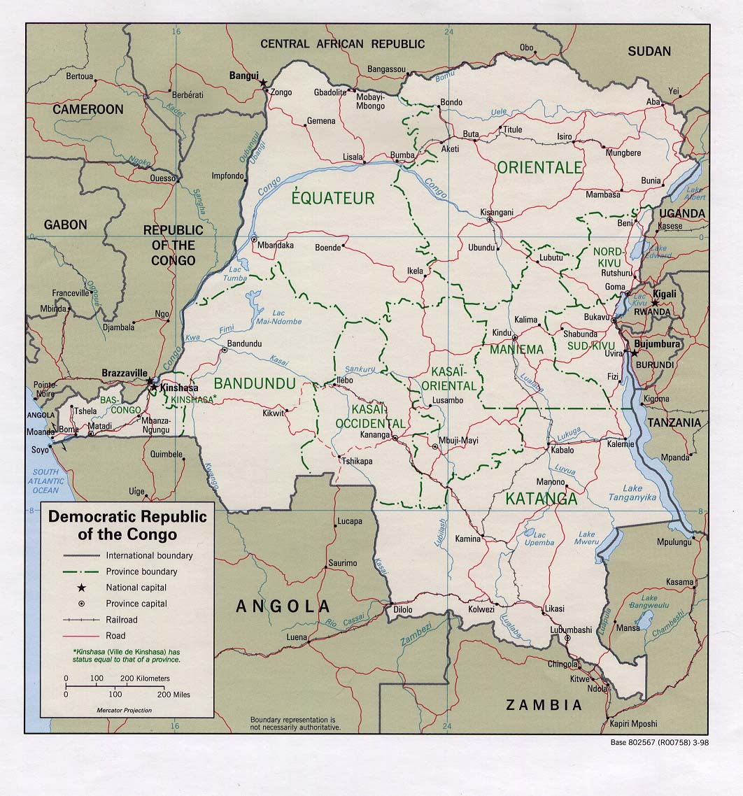
| Congo (Kinshasa) | province | zone | CIA HCR Map Mgl PDF PDF | Zones | ||
| Cook Islands | none | Stats | Map | -10:00 | ||
| Costa Rica | province | canton | Stats Stats | Post Post | Atlas CIA Mgl PDF | -06:00 |
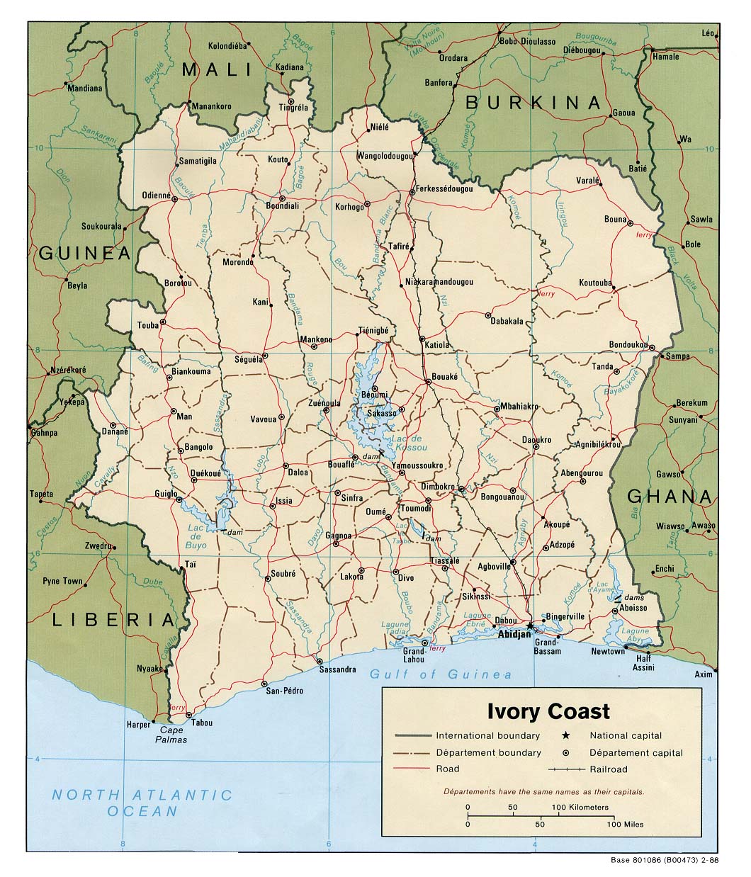
| Côte d'Ivoire | district | region | Stats | CIA Map Mgl PDF PDF | 00:00 | |
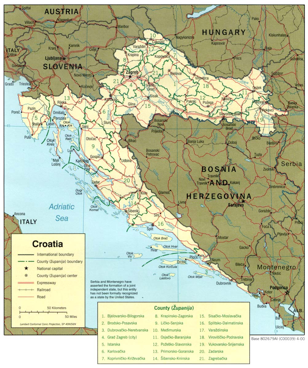
| Croatia | county | commune | Stats Stats | CIA Clik | +01:00 D | |
| Cuba | province | municipality | Stats Stats Stats Stats Stats Stats Stats Stats | CIA Clik Mgl PDF | -05:00 D | |
| Curaçao | none | -04:00 | ||||
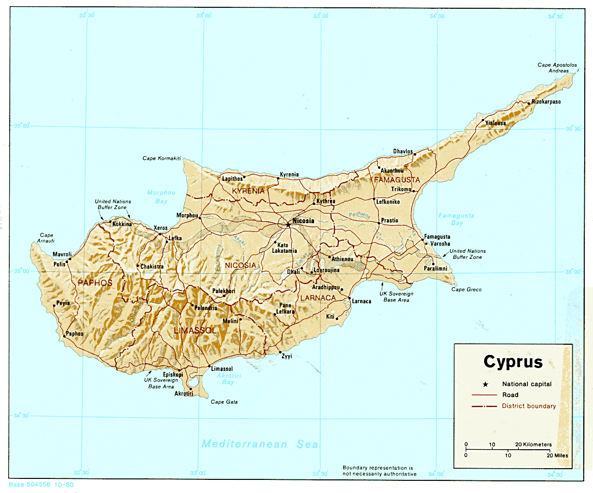
| Cyprus | district | Stats Stats Stats Stats NCypr | CIA PDF PDF | +02:00 D | ||
| Czech Republic | region | district | Stats Stats Stats Stats | CIA Mgl PDF | +01:00 D | |
| ||||||
| To find links for another country, click on its initial letter here: |
|
| To find out which pages on this site have recently been updated, visit the newsletter page. |
Behold, the nations are as a drop of a bucket, and are counted as the small dust of the balance. - Isa. xl:15a.
| Back to main statoids page | Contact me |
| Copyright © 1999-2016 by Gwillim Law. | |